Wednesday, 13 October 2010

The Multangular Tower and south-west wall of Eboracum

My home city of York is blessed with significant Roman remains and I just wanted to post a little on the Roman fortress, in particular the south west wall.

The Roman fortess at Eboracum occupies a site on the northern bank of the River Ouse with the principia located directly under the minster. What is apparent is that the south west wall is constructed significantly differently to the remaining three walls and I just want to explore this a little more.


The multangular tower. The front left corner of the York fortress probably rebuilt by Constantine I in the early third century AD. The later Mediaeval brickwork in larger stone is clearly evident to the top of the tower.

One of the most recognisable features that sets this wall apart are the two "multangular" towers with 10 facets (14 if they were to be constructed to join up) that sit at the extreme ends, only one of which is still visible, located in the Museum Gardens of the Yorkshire museum. The external nature of these two corner towers is unusual, although not unknown, and it has been postulated that because similar towers are found at Gamzigrad in Dacia, the location of the palace of Galerius, where construction began at the beginning of the fourth century.

The interior of the multangular tower with the holes visible in the wall for the false floor and late Roman stone sarcophagi in the base.

Another feature of this south east wall, not reproduced on the other three walls of the York fortress, are the external butresses to the interval towers. This method of construction is known from Britain on the Roman forts known as the Saxon shore forts, although those do not posess the distinctive corner towers observed at York. Numismatic evidence dates the Saxon shore forts to be constructed from late in the third century through to the first couple of dacades of the fourth.

The small stonework and upper brick layer of an external tower on the front of the Roman fort at York dating from the fourth century AD.

So, on the face of it there does seem to be justification, in the absence of other evidence, for an early fourth century date for the construction of this particular wall, if no a reworking of all four walls at York.

One question that is hard to answer is why only undertake this work on one wall of the fort? A cynic might say that it was purely for appearences, the look was more important than the substance. This wall certainly houses the Porta Praetoria, the gate that was the main entry into the city and prestige could be an option.

It also faces a structure on the oppisite bank of the river that was the residence of the Governor of Britannia Inferior (the fourth century division of Roman Britain into "Superior" and "Inferior" is well documented).

Finally, could it be the result of an imperial presence "gentrifying" or "grandifying" the entrance? Constantius Chlorus (AD 305-6) was resident in York when he died, along with his son Constantine ("the Great"). The death of Constantius precipitated Constantine being proclaimed emperor by the troops. We also have the possibility that it was done for a potential subsequent visit of Constantine to York around the time of his quinquennalia or 5th anniversary of his accession.

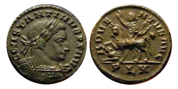
Constantine I London Mint ADVENTVS AVG follis, an imperial entry into Britain

Constantine spent his quinquennial year (July 310-July 311) in the western provinces. The Latin panegyrics note a visit to Autun possibly just after July 211 and no other visits listed BUT Eusebius, in Book 1 of his "Life of Constantine", does have a passage of interest:

"Having disposed of these affairs to his satisfaction, he directed his attention to other quarters of the world, and first passed over to the British nations, which lie in the very bosom of the ocean. These he reduced to submission, and then proceeded to consider the state of the remaining portions of the empire, that he might be ready to tender his aid wherever circumstances might require it."

The passage, coming just before the passages dealing with the war against Maxentius that concluded with the battle of the Milvian Bridge in 312, would apparently date his British caampaign to 310/11, a visit that would coincide also with the quinquennalia and one might find it reasonable to propose an imperial visit at this celebratory time to the place of elevation which, in itself, could have brought about the cosmetic improvement to the fortress.

Tuesday, 12 October 2010

When on Google Earth 102

Having recently identified the Shankh Monastery in Mongolia that was WOGE 101 it is now my turn to host. This is my challenge; be the first to correctly identify the site below, and its major period of occupation, in the comments below, and you can host your own!


The rules:
Q: What is When on Google Earth?
A: It’s a game for archaeologists, or anybody else willing to have a go!
Q: How do you play it?
A: Simple, you try to identify the site in the picture.
Q: Who wins?
A: The first person to correctly identify the site, including its major period of occupation, wins the game.
Q: What does the winner get?
A: The winner gets bragging rights and the chance to host the next When on Google Earth on his/her own blog!


Be the first to correctly identify the site below and its major period of occupation in the comments below and you can host your own!


More When On Google Earth
For a list of previous winners see Electric Archaeologist here …
or join the Facebook group here….

CLUES

A clue has been asked for. The site lies in a town that, tradition tells us, was founded by Thorgils Skarthi in 966. This site, however, is a multiperiod site and has a feature that predates the town foundation.


Sunday, 12 September 2010

Iron Age hill forts

As you may have worked out I've been in Dorset recently and have got to visit a couple of Iron Age hillforts recently.

The first was Blackbury(sic) Camp on the outskirts of Beer.

The ramparts are still relatively high, showing an unusual entrance feature. The fort occupies the end of a large ridge at some 185 metres (607 ft) above sea level.


It was defended by a single bank and ditch, forming a roughly D-shaped enclosure.


A triangular barbican was added to the south but was never completed.


The fort was probably occupied in the second and first centuries BC by a cattle-farming community.

The second one, that I got to see on my 44th birthday, was Maiden Castle in Dorset, the best preserved Iron Age fort in the UK.

Originally built during the Bronze Age it was remodelled to finally posses a very complicated east and west gateway arrangment.


The defensive ramparts, and their steepness, also need to be seen to be believed.
The site also boasts a small 4th century Romano-British temple, constructed long after to site was abandoned. Based on a plaque discovered during its excavation the dedication was to Minerva.
Finally, to the north east, you can see a large Bronze Age round barrow ("bell barrow" form).

Tuesday, 7 September 2010

Archaeology in the rain....

Well, I guess yesterday with an utter downpour from lunchtime through to 7pm wasn't the time to enthuse my partner Val and her sister in archaeological sites.
We'd just left Portland Bill in heavy rain where they both spent some very happy childhood years (including lunch in the Lobster Pot but they no longer serve "Hubbly Bubbly" to drink) when I slammed the anchors on the car and stuck it into reverse. I hadn't noticed it on the way down there but there was a mesolithic site, Culverwell, on out way back.

Culverwell mesolithic settlement

A small settlement site, now just a series of grassy mounds, from c.5-6,000 years BC was evidence of a semi sedentry life, living off seafood in early Britain.

We continued on to Weymouth and the rain continued to pound. Having driven along the seafront I took my captive passengers to a small Roman temple site on the eastern edge of town, located on Jordan Hill.

Weymouth Roman temple

There is little, other than the foundations of the interior structure of the shrine, that is visible on the hill but the sea views are impressive and also this would have been clearly visible from the sea . Sadly this was not the day to appreciate them. There is no information as to whom the temple was dedicated but given the position Neptune (for the sea) or Mercury (for trade) would not be out of place.

The final treat for my passengers was a visit to the Cerne Abbas giant.

The "Giant" through the rain

The figure, carved into the hillside, was only just visible given the appaling weather. Naked (apart from sheep), and holding a club (with a "cloak" still uncovered on the other arm) the figure looks like a crude representation of Hercules. The date does prove something of a conundrum. Some postulate it is Roman or sub Roman, whilst others suggest it is of a much later date, 17th century perhaps, being first recorded in documents of 1694.

Sunday, 22 August 2010

The quinquennalia of Carausius

It is surprising how taking a fresh look at a worn coin will give you a different reading and that has happened to me with this coin:
Carausius 287-93
Antoninianus
Obv"IMP CARAVSIVS P AV"
Radiate, draped and cuirassed bust right
Rev "[VO]TA QVI C[AE]"
Roma seated on shield left
-/-//[MX?]
RIC - (cf 1095)

I thought it had read ROMA CONS, however, what I thought was ON at the top of the coin is actually QVI and is actually a coin from his quinquennalia, the vows discharged after five years reign and looking forward another 5 years to his decennalia or 10th anniversary (MX below the seated Roma, not really visible on this coin being short for "MVLTIS 10").

I was familiar with the two or three known similar examples and even commented on the similarity of my specimen without making the final leap into attributing as such. Re-examination of the reverse lettering has now confirmed it for me, after being mis-identified for eight years or so.

Thursday, 19 August 2010

The Frome Hoard of Carausius


I was invited down to the British Museum yesterday by Sam Moorhead for lunch and to discuss the work he’s currently doing on Carausius, both with the recent Frome hoard and the older Elveden hoard.

As well as seeing the small public display I got to have a quick look at the rest of the hoard, bagged and in boxes and most of it awaiting conservation, as well as the two denarii and a handfull of already conserved coins not on public display.


The denarii are as impressive as the pictures, if not more so and far exceed the quality of the remaining Carausian denarii in the BM's collection.


What is interesting is that the hoard has been carefully excavated down through the pot and seems to have been assembled from smaller pots. The reason for this hypothesis is that it seemingly terminates with London B/E coins (c.290) yet the greatest concentration of Carausius coins by far, including these terminal coins, was in the middle layer. The denarii, struck early in the reign, were found in the upper layers.


Hopefully a small booklet will be out shortly, within a week or two, to summarise the hoard (similar to what was produced for the West Midlands Saxon gold finds) with a full academic publication in due course.

Friday, 13 August 2010

An Edward Jekyll update.......

It's been a while since I posted here but (hopefully that will change).

I can report a small update in identifying the Edward Joseph Jekyll named on a Victorian bookplate (see HERE for the original posting).

I was leafing through Harrington Manville's book 'British Numismatic Auction Catalogues, 1710-1984' when I came across a sale catalogue of Sotheby's from 15-16 June 1915 which listed the collection of early British, Anglo Saxon and English coins of Edward Joseph Jekyll of Ampthill.

As the younger Captain Edward Jekyll died in 1921 I suspect that this is his collection (and therefore he was the previous owner of the book in the original post). That is not to say that any collection or library of the elder Edward Jekyll wasn't passed down to his son.